
The Grose Valley is the wildest of the Blue Mountains' three great valleys. A guide to Govetts Leap, Bridal Veil Falls, Evans Lookout, Anvil Rock and the wind-eroded cave — with a rockface full of surprises.
Read More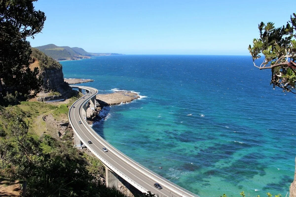
Sea Cliff Bridge on the NSW South Coast — why it was built, how long it is, where to park and why it's worth walking across. About an hour south of Sydney on Lawrence Hargrave Drive.
Read More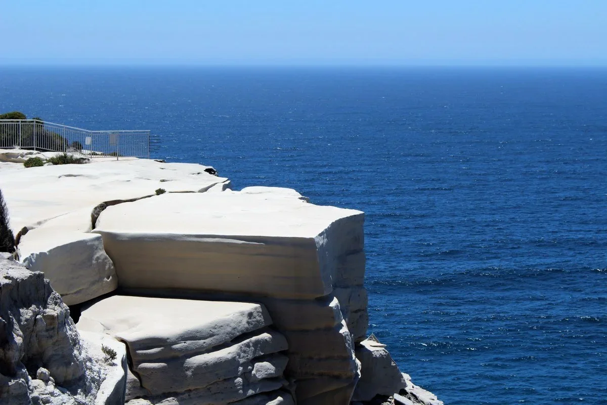
A Wedding Cake Rock tour is one of the specialty tours offered by Sydney Nimble Tours. Our Royal National Park tour includes Wattamolla waterfall and lagoon and Garie Beach. Outside of the park we can visit Symbio Wildlife Park as an additional option.
Read More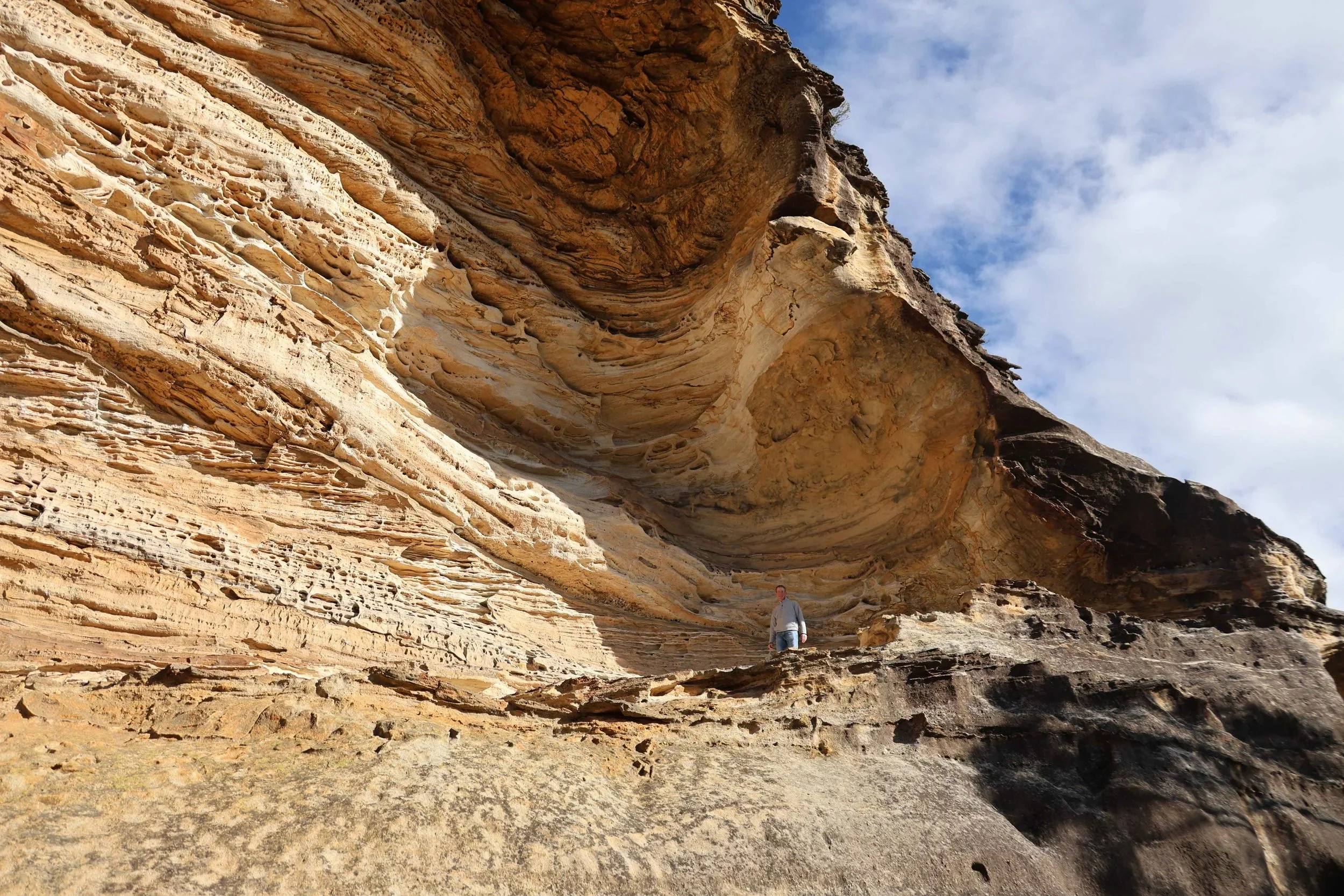
Sydney's sandstone formed 220 million years ago and shapes everything from the Royal National Park's coastal cliffs to the QVB. A guide to the geology behind the city and its surroundings.
Read MoreHanging Rock in the Blue Mountains is a sandstone formation cantilevered above the Grose Valley — a 10km return walk from Blackheath with dramatic cliff-edge views. Suitable for guests comfortable with heights.
Read More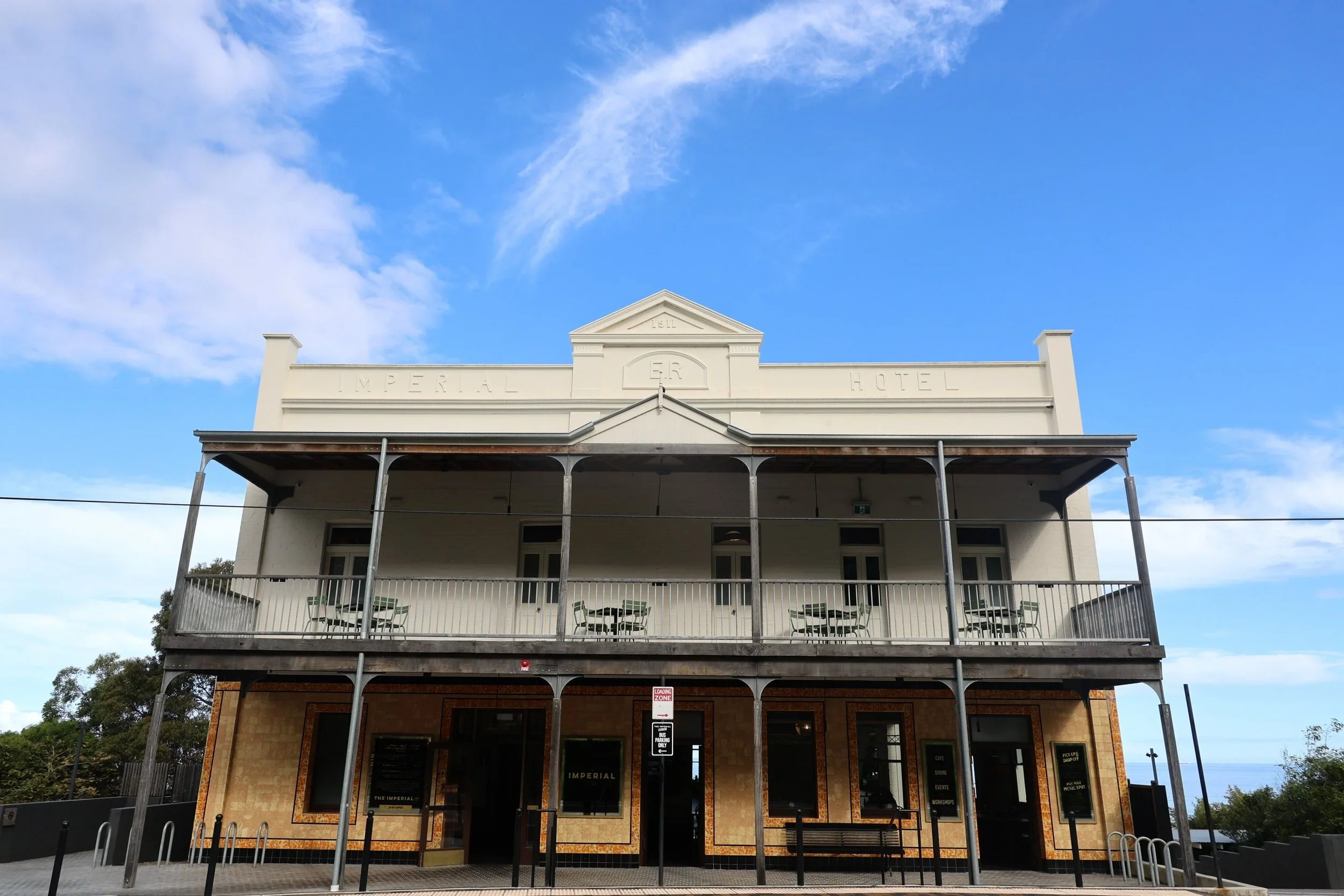
The Imperial Hotel at Clifton is a restored 1911 heritage pub on Lawrence Hargrave Drive — a stop with history, ocean views and good food on the NSW South Coast
Read MoreIn spring and summer, bluebottles are a fact of life on Sydney beaches. A strong nor-easterly overnight and you'll find them scattered across the sand by morning — sometimes in their hundreds. Here's what they are, when to expect them, and what to do if you get stung.
Read More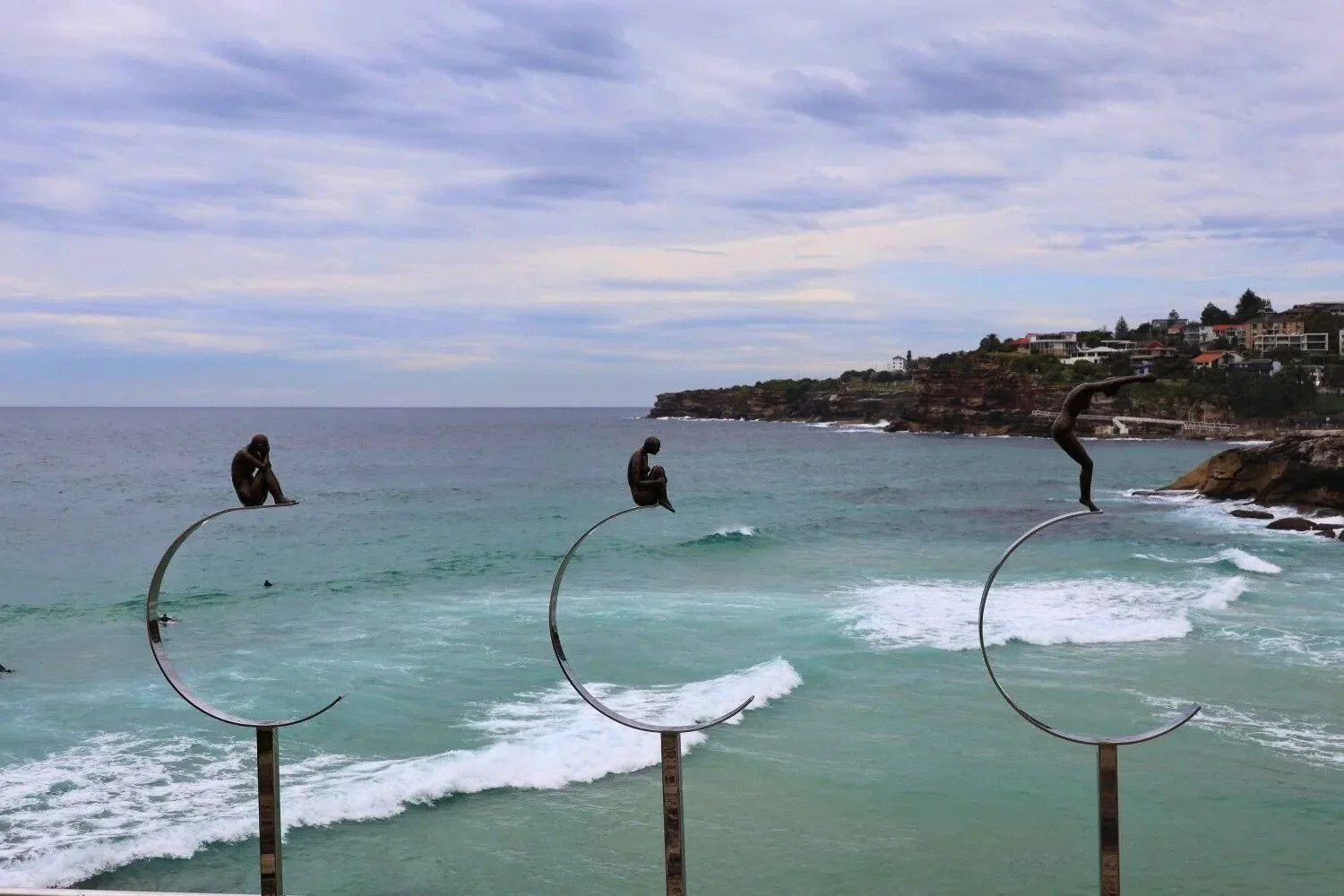
Sculptures by the Sea runs every October along the Bondi to Tamarama coastal walk — the world's largest free public sculpture exhibition. What to expect and when to visit.
Read More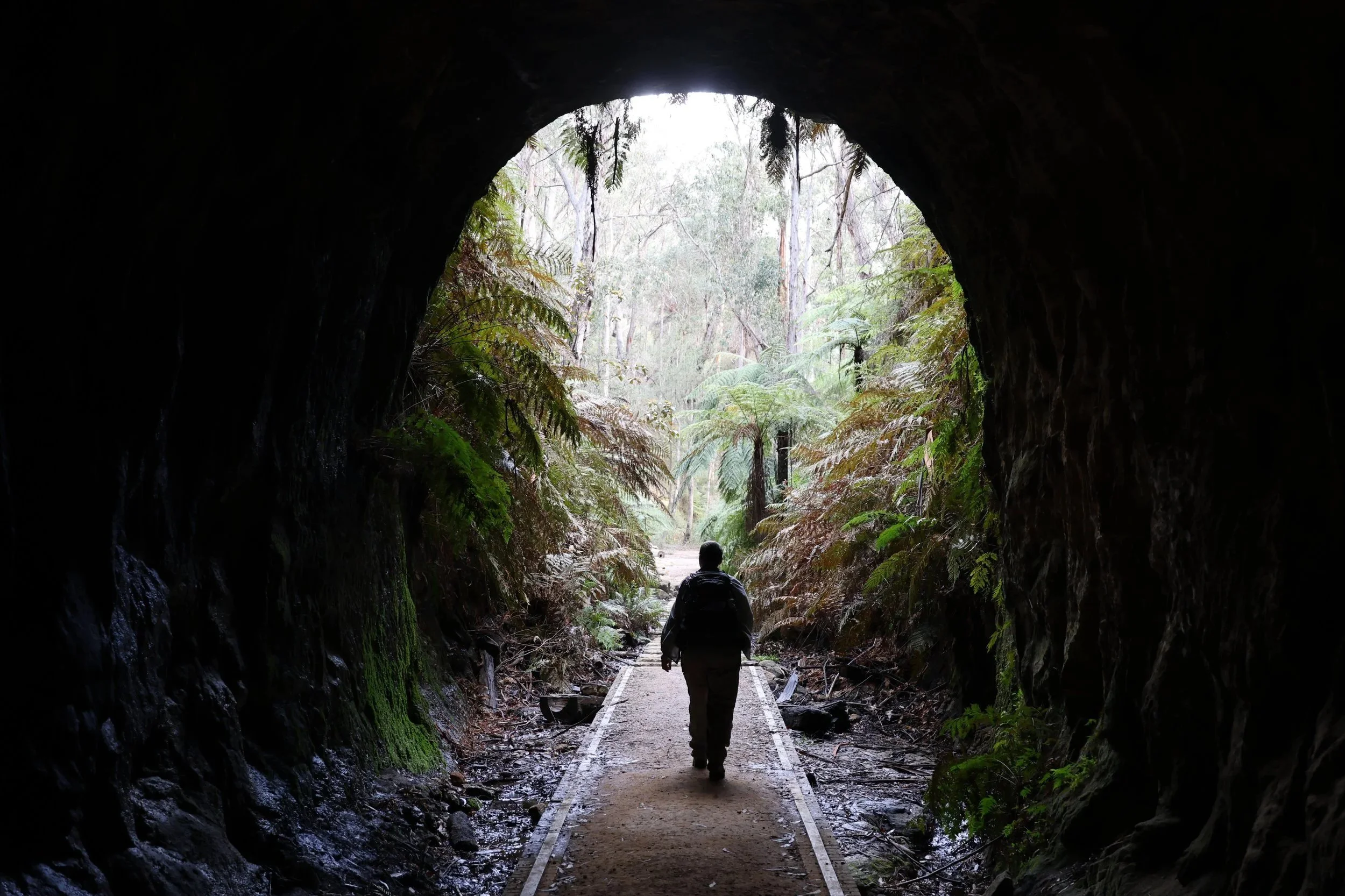
The Blue Mountains glow worm tunnel near Lithgow — a disused railway tunnel where bioluminescent larvae light the walls in complete darkness. One of the more unusual stops on a Blue Mountains day.
Read More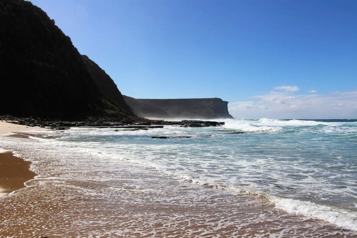
Garie Beach is the largest and most open beach in the Royal National Park - 900 metres of sand, forested headlands, and genuine wildness less than an hour from Sydney.
Read More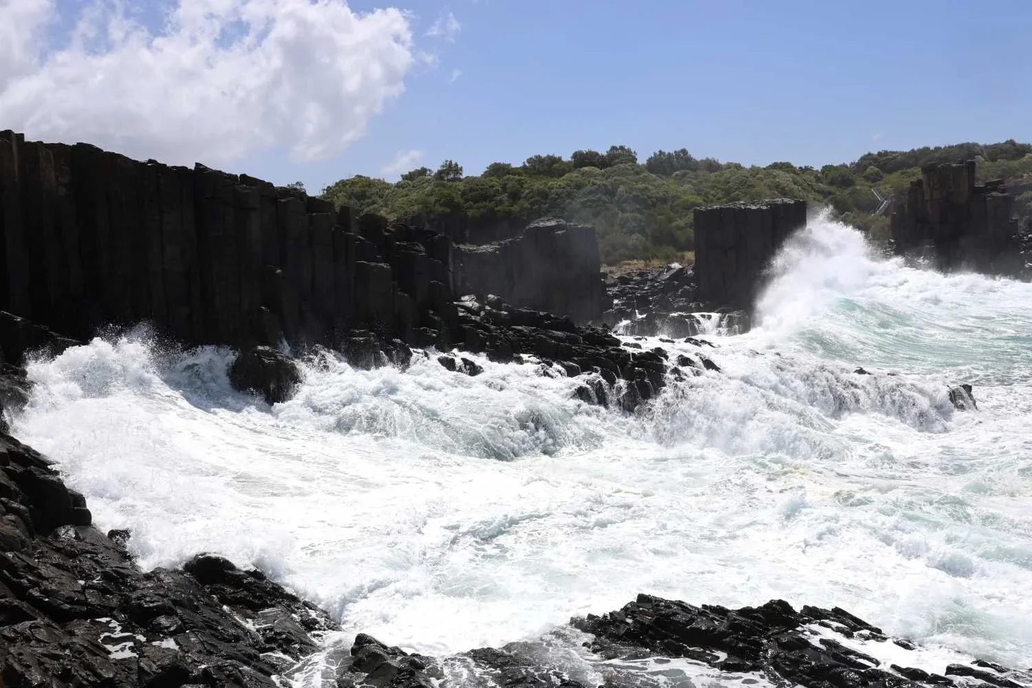
Bombo Headland Quarry near Kiama contains hexagonal basalt columns formed 270 million years ago — one of the most visually striking landscapes on the NSW South Coast.
Read MoreNorth Head at Manly offers a 60-75 minute loop through hanging swamp, sandstone lookouts and the Third Quarantine Cemetery — and one of Sydney's best whale watching spots from May to November.
Read More
The Zig Zag Railway near Clarence runs heritage steam trains through sandstone cuttings and across 19th-century viaducts. Operates around six days a month — can be included on a Blue Mountains private tour.
Read MorePier 2/3 at Walsh Bay is a heritage timber wharf converted into performance and rehearsal spaces for the Australian Chamber Orchestra, Bell Shakespeare and Sydney's young people's theatre. Open to the public since March 2022.
Read MoreWalk from Wattamolla Beach to Eagle Rock and Curracurrong Falls, Royal National Park. One of only 3 waterfalls in Australia that plunge into the ocean. 8km return.
Read More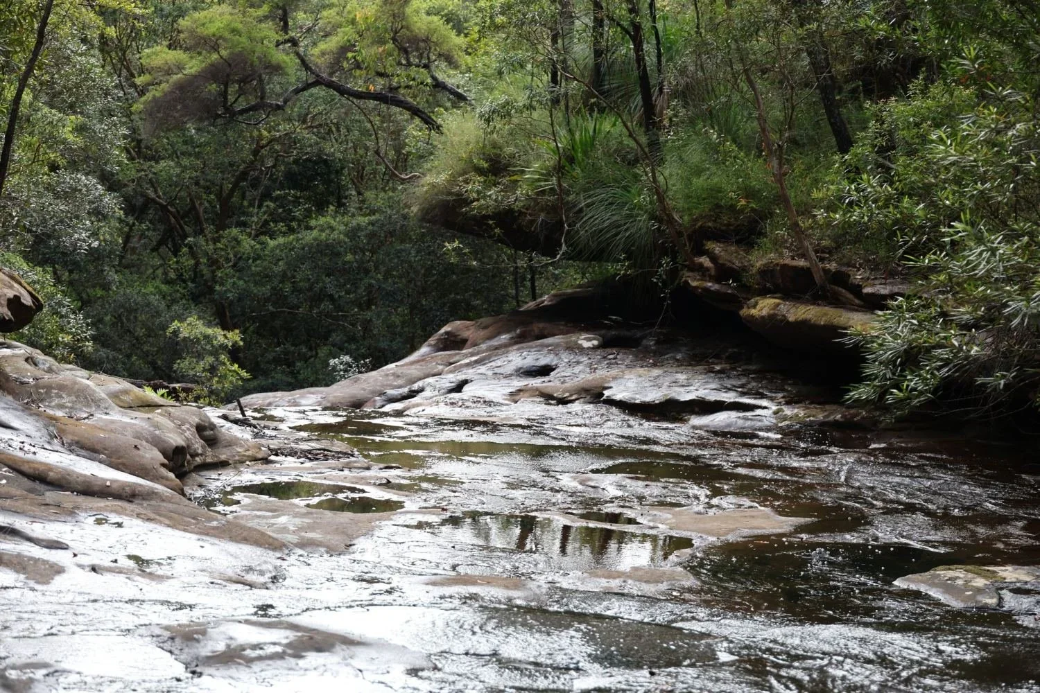
Palona Cave in the Royal National Park — a sandstone cave containing rare limestone stalactites and stalagmites. How to get there and what makes it unusual.
Read MoreMore than 40,000 humpback whales migrate along the Sydney coastline from May to November. Eagle Rock in the Royal National Park and North Head at Manly are two of the best shore-based viewing spots.
Read MoreThe Australian Raven and New Holland Honeyeater are regular sightings on the coastal walk to Eagle Rock and Wedding Cake Rock in the Royal National Park. What to look and listen for.
Read More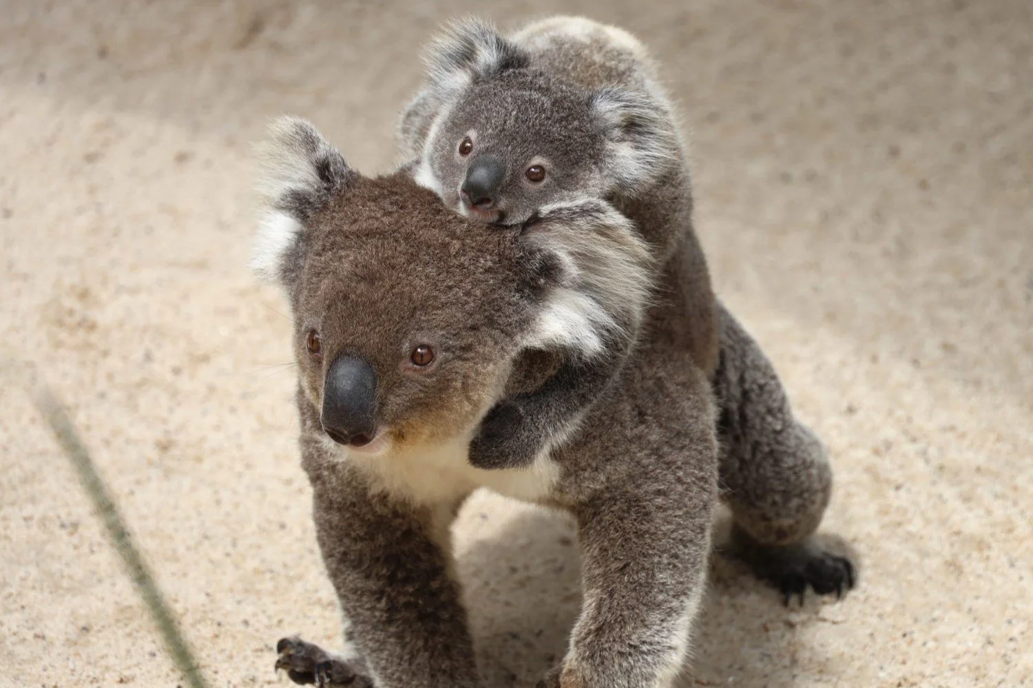
Symbio Wildlife Park sits just outside the Royal National Park near Helensburgh — koalas, Tasmanian devils, kangaroos and more, with optional add-on to a Royal National Park private day tour.
Read More